Sunday, 21st January, 2024
- Day 1/3
- 33%
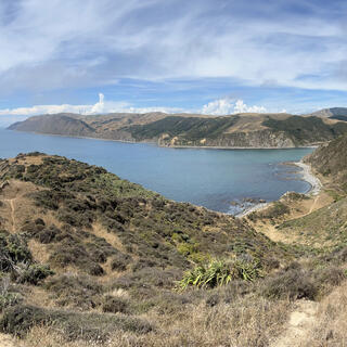
Braving the blind corners of Mākara Road, I hike up to Fort Opau before tackling two major obstacles on the coast.
Braving the blind corners of Mākara Road, I hike up to Fort Opau before tackling two major obstacles on the coast.
One of the major drawcards for this hike was that it was easily accessible - sort of.
After biking my gear into town, I leave my bike at work and hop on a bus to the suburb of Karori, which is as far northwest as you can get by public transport. Truth be told, there is a bus which runs to the Mākara cemetery on the third Wednesday of each month (opens new window), but that's not of much help on a Sunday, plus the cemetery is only 3.5 km down the 11 km Mākara road anyway.
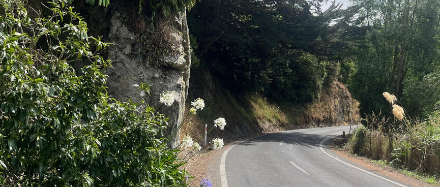
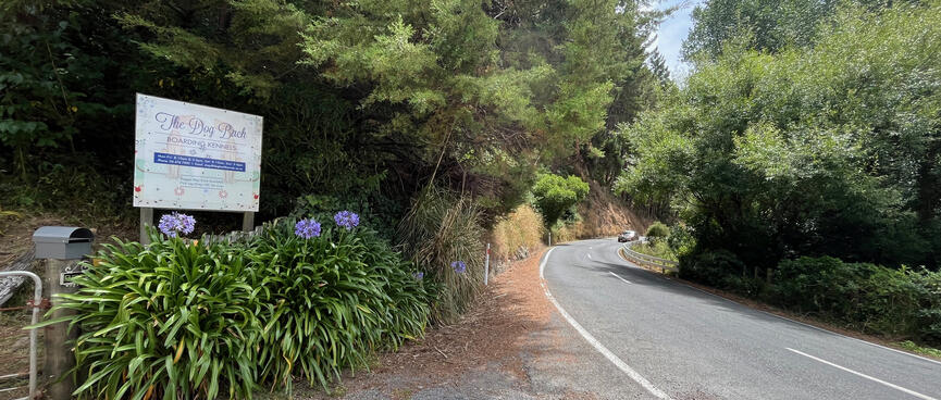
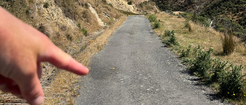
After collecting a local Olio trade, I set out on the walk down Mākara Road to Mākara Beach, my real starting point for the hike. It's just before 10:30am and I've estimated that the commute will take up to 4 hours - with the the road not being pedestrian friendly I'll need to be looking over my shoulder the entire way.
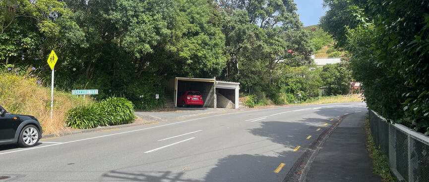
On the way up the hill I pass a street sign for Terawhiti Tce. It's a fitting waypoint as my hike will take me to Cape Terawhiti, the southwesternmost point of the North Island of New Zealand. I'm expecting the actual Cape to be far more wild than this quiet suburban street.
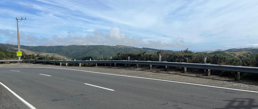
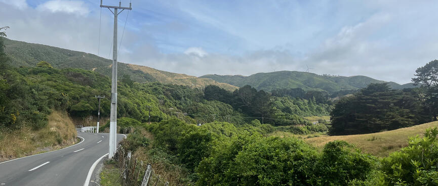
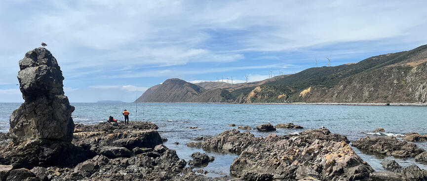
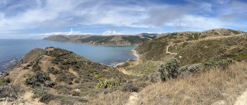
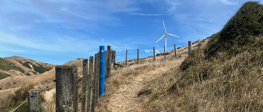
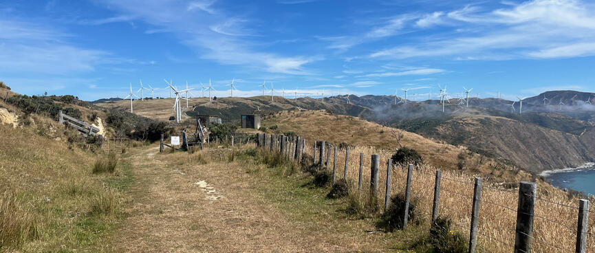
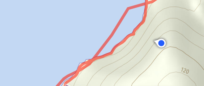
At the top of the hill I spot the Mākara wind farm in the distance. That's where I'm heading, though with the hills belonging to Meridian Energy and Terawhiti Station my actual route will take me around the coastline below.
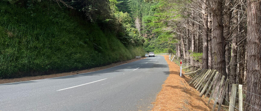
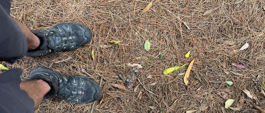

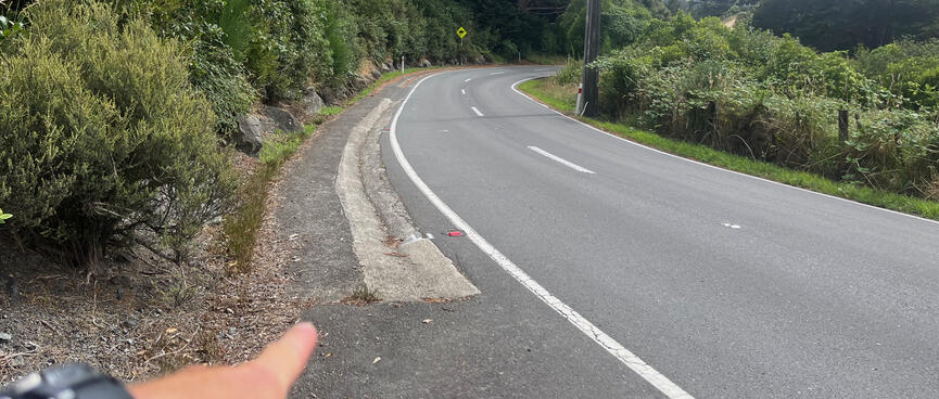
Orangey-brown pine needles coat the thin strip between the edge of the road and the fence.
The spongy underlay is pleasant to walk on but I look pensively at the corner in the distance. There's no footpath here so I'll need to be alert for cars coming the other way.
Around the corner the pine needles are gone so I walk the 30 cm strip next to the fenceline.
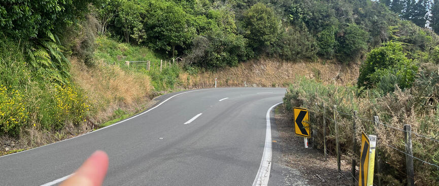
The next corner is completely blind so I stop and wait until I cannot hear any vehicles, then quickly cross from the right hand side to the left. Then, following the snake, I cross the opposite way at the next blind corner.
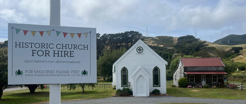
At Mākara Cemetery, I'm surprised to find that the church on the right is non-denominational.
Imagine if we had non-denominational bank notes? Maybe what they mean is that any denomination is welcome, but surely Saint Patrick had made his mind up.
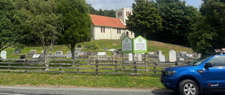
On the other side of the road, a squat concrete building perches on a low hill. With its square tower it looks positively medieval. Named after St Matthias it offers Holy Communion and space for the deceased to lounge in sun drenched burial plots below.
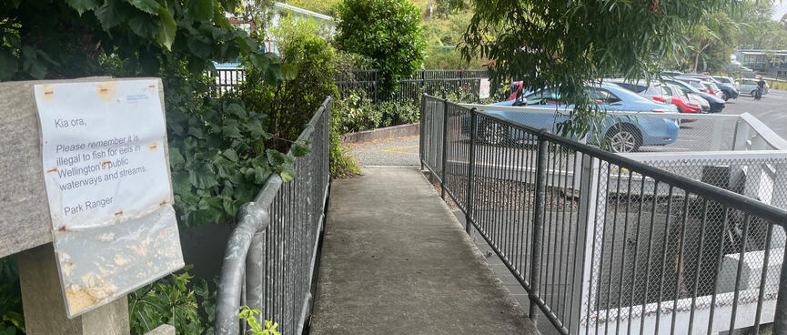
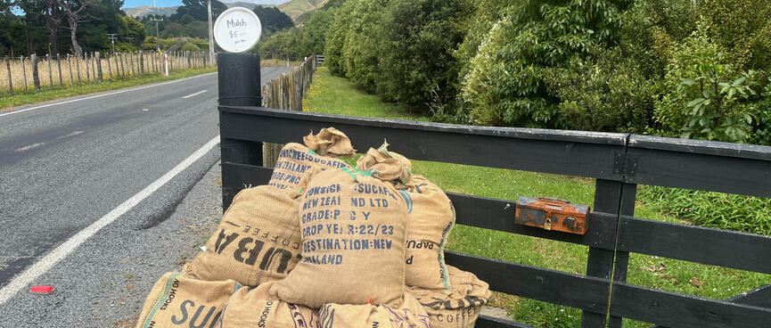
Just down the road there's a creek with a friendly 'reminder' from the Park Ranger not to fish for eels there. And there's a roadside stall selling 60 litre bags of mulch for $5. The mulch comes in large hessian sacks marked CUBA COFFEE and I assume that they're coffee husks - the dried skin of roasted coffee beans. I think they're what Kaicycle use on their highly successful urban farm. I'd like the same magic in my garden and make a mental note to come back later.
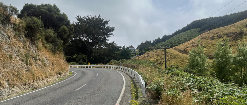
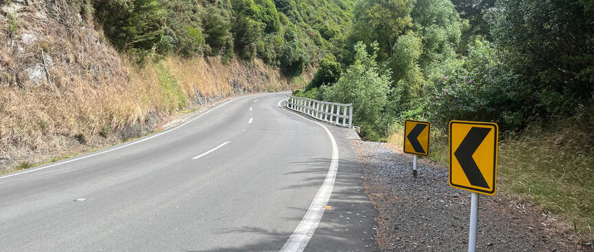

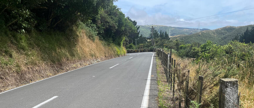
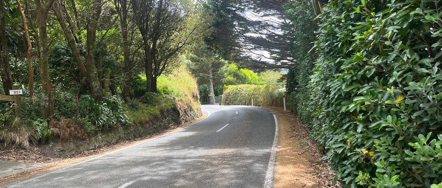
Leaving the cemetery area, the road resumes its narrow bendy ways.
The narrow shoulder is at its most challenging when encroached upon by the white fences probably intended to protect road users from roadside drops.
With natural stone walls pushing up against the white line on the left and the river running below the trees to the right, the timid asphalt road is forced to bend and squeeze its way between them.
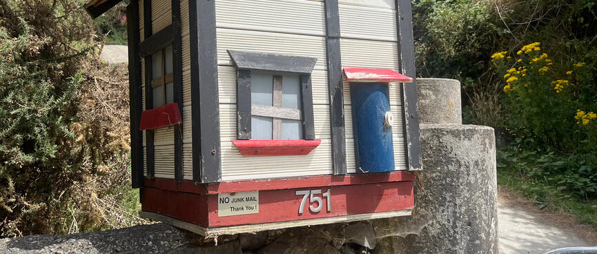
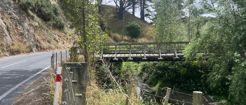
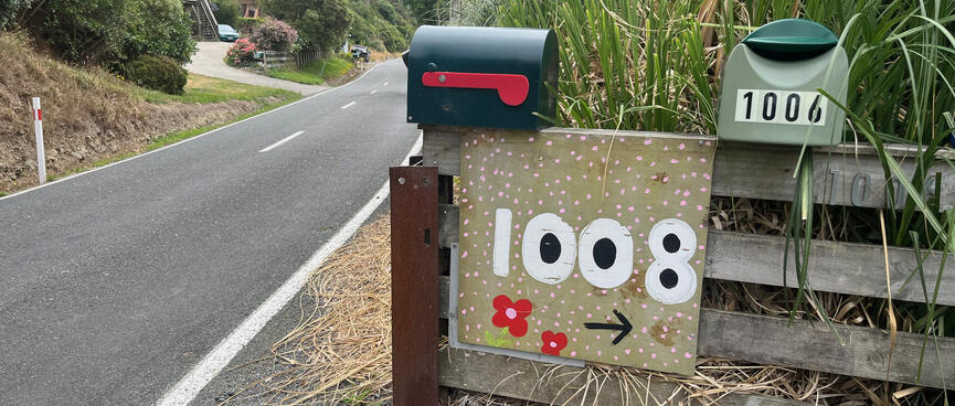
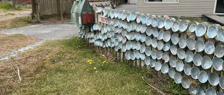
As I continue down the road, natural features are interrupted by man-made structures, homely home-made letterboxes and private bridges crossing the river.
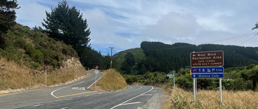
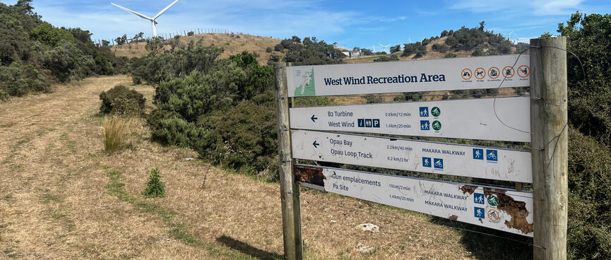
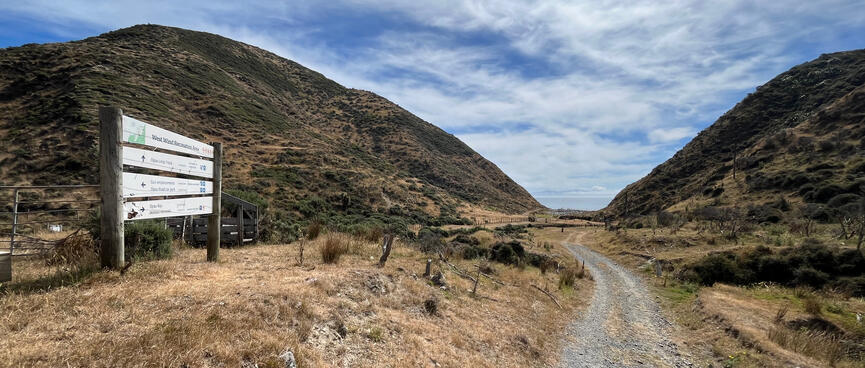
A sign marks the turnoff to West Wind Recreation Area.
Fearing that it's the kind of place where giant disaffected wind mills run amok killing holiday makers, I elect to continue on towards Makara Cafe (I was going there anyway).
At The Dog Bach boarding kennels, a enthusiastic choir of canines belt out an unwelcome welcome, frustrating my attempts to listen for approaching traffic.
Further down the road bunches of road cyclists whizz by at breakneck speed. With no time or inclination to shout out "one more!" I give them the benefit of a long wait before sprinting across the road, nearly colliding with a motorcyclist whose electric machine is almost silent.

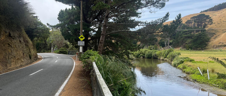
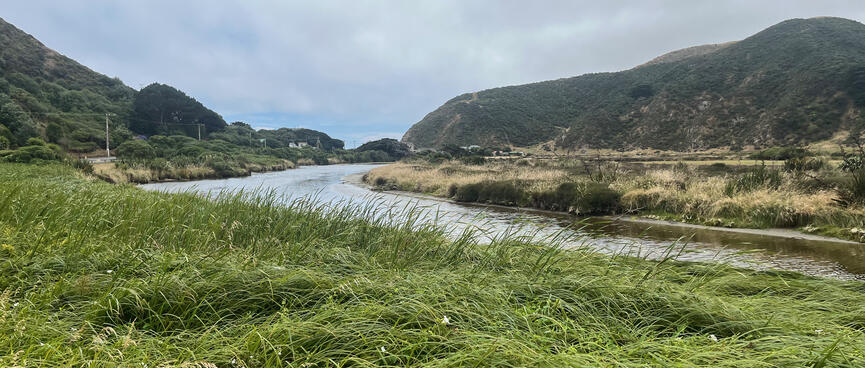
As I near my destination, road and river hang a left towards the beach.
Heeding the request to PASS WIDE AND SLOW, the traffic dies down and the lazy brown-and-now-blue river barely breaks a ripple.
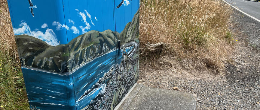
Local residences seem to be a mix of friendly and exclusive. An artistic power box paints a scene of seagulls floating above driftwood structures on a remote beach. Coastal perfection.
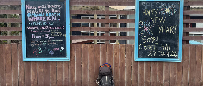
Like most people heading down to Mākara Beach today, I had secretely hoped to sit down to a long and relaxing lunch at the popular Mākara Cafe.
So, like most of those people, I'm a little disappointed to find that the cafe is still closed for the Christmas holidays. This probably explains the stready stream of cars boomeranging their way back from the beach mere minutes after passing me on the way down there.
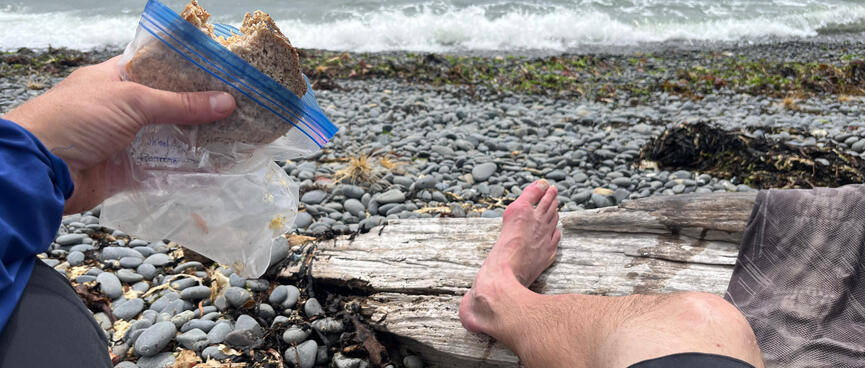
Luckily I packed a peanut butter sandwich, my usual with homemade bread and sprouted seeds. It's my last meal in a sense, for I've packed lots of food but the menu is limited to filtered water, dehydrated bananas and chocolate OSM (One Square Meal) muesli bars.
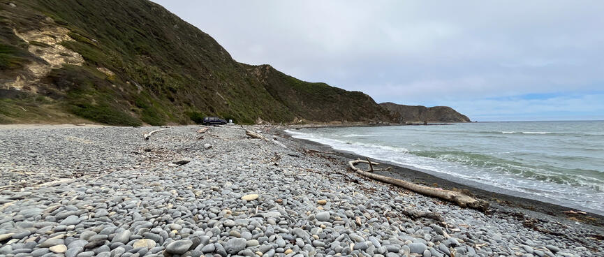
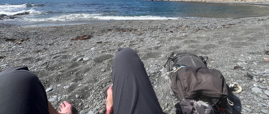
Sitting on the rugged beach, the water doesn't look very appealing - it's a murky green colour and a bit rough. But a woman is bathing nearby, so when she gets out I ask her how it is and whether it's safe to go in. She says it's safe enough - as the tide is coming in - but too warm for her. Apparently she's just done a big hike and was hoping the dip would cool her down.
Stripping off to swim in my shorts, I wonder if she's just done the same hike that I'm about to do. I find the water temperature pleasant enough, but the beach isn't sandy and the pebbles make it uncomfortable to get in and out - especially out, as white waves throw me up against the sudden slope of the stoney beach.
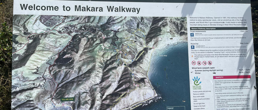
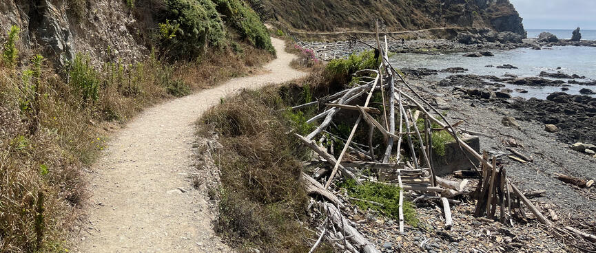
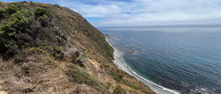
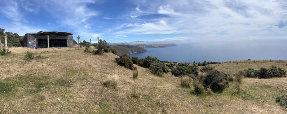
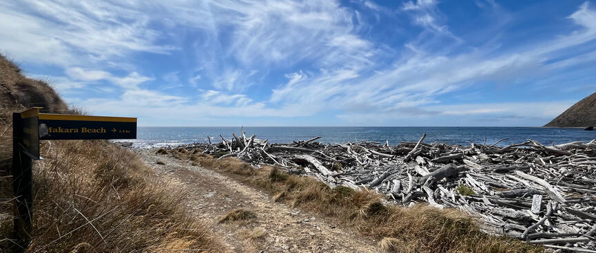
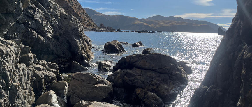
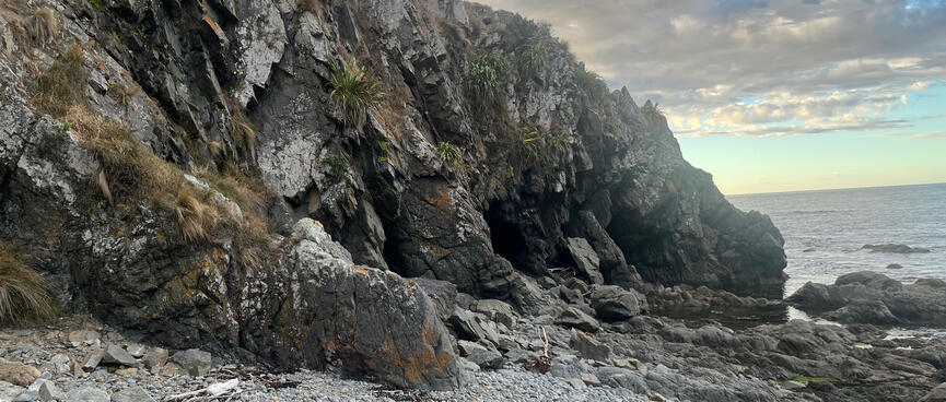
At the end of the beach, the hike proper starts with Mākara Walkway, which runs around the coast before heading up to the Fort Opau gun emplacements.
The manicured path starts off very sedately, passing fishermen, hopeful seagulls and the same driftwood teepee I saw painted on the power box.
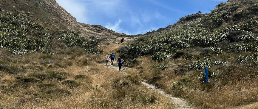
The trail forks at the base of a hill. Apparently it's 1.5 km to Opau Bay either way, but I'd read that the coastal route was shingly and therefore slower, so I head up the hill. The track climbs steeply challenging multinational tourists, some of whom run out of steam on the way up. Resting their hands on their hips they admonish themselves for agreeing to accompany their hiking buddies up here.
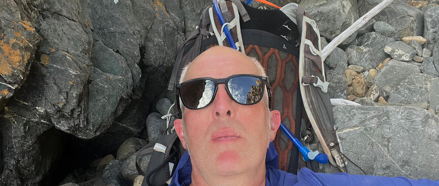
Having just walked for three hours, I'm not especially enjoying the climb either, especially with a 10 kg pack. I'm wearing a new lightweight 'sun hoody' which probably highlights the fact that I'm sweating profusely. This might be why I get a few winks as I struggle up the steep path in the hot sun.
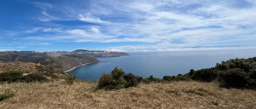
It's not an ideal start to the hike, but the views are fantastic and in the distance I can see places where I might be travelling to next.

My camping Option A was to arrive at the gun emplacements just as everyone was leaving and spend the night there.
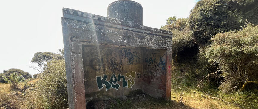
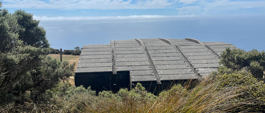
But with the cafe being closed I'm way ahead of schedule and there are still plenty of people about. It's just as well, as most of the structures are signposted as unstable and fenced off accordingly. Those that aren't look like they suffer regular abuse from undesirables. That would leave hiding between the bushes, as the trail signs specifically prohibit camping. I've allowed for three nights out so I'm definitely going to camp tonight, just not here.
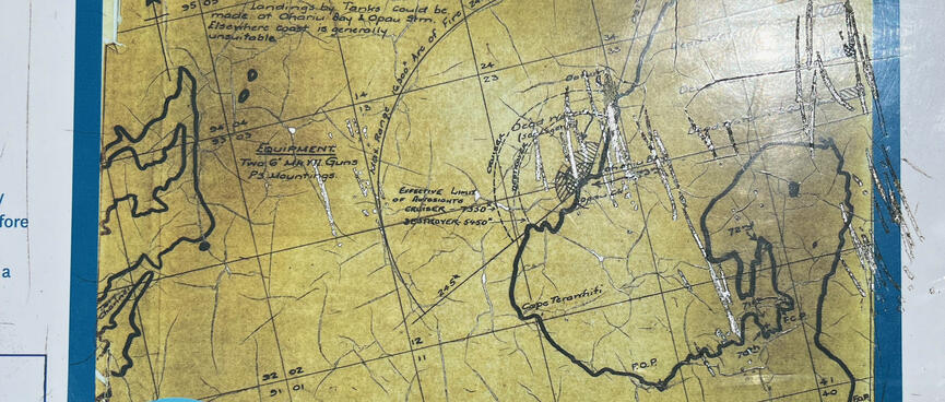
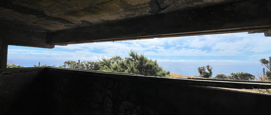
As I enter the complex of scattered structures, mist starts rolling in. A signboard explains that the two 6" guns located here during the Second World War could easily reach Cook Strait, but cloud and fog often obscured the gunners' view.
One half of a young couple asks me where I'm headed and when I answer he says that he hopes that the weather stays fine - it looks like rain. I'm okay with rain, it's crazy wind in exposed remote locations that I'm most fearful of. Yesterday was really windy, but the forecast is for things to settle down, so I have my fingers crossed that the wind behaves and Mother Nature keeps me safe on my travels.

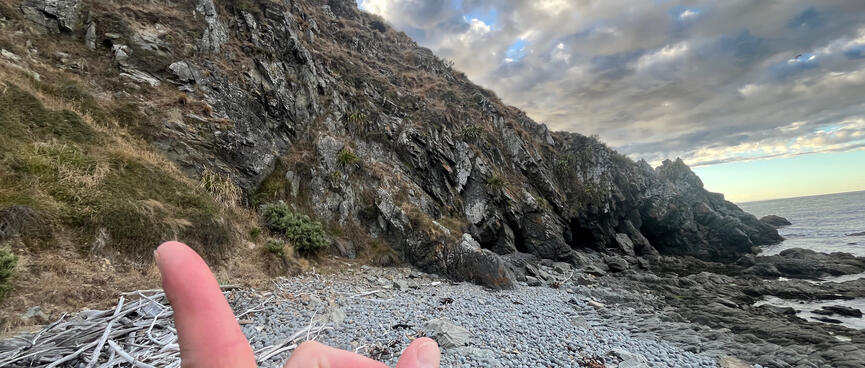
The trail continues up to the wind farm but I turn off onto a very steep road leading down to Opau Bay.
I try to imagine battling up it with a loaded touring bike, but the gradient is just too extreme. Even though I'm heading down rather than up, this feels like one of those trips where the bike is better left at home.
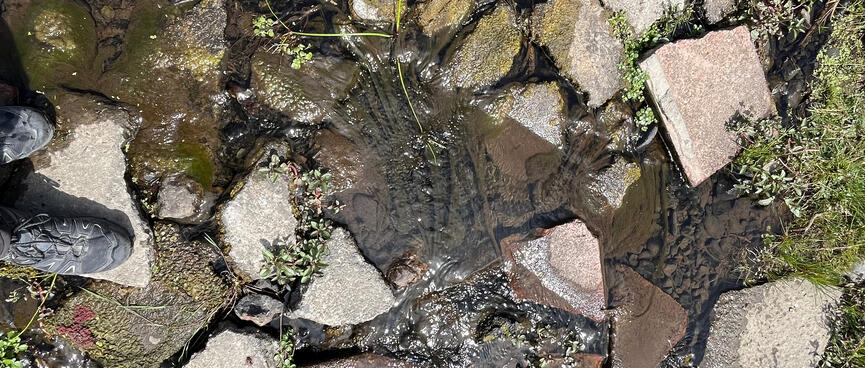
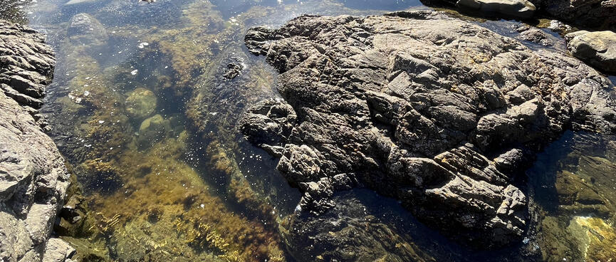
Reaching Opau Bay beach requires crossing a small stream. I consider filling up my Camelbak Crux hydration bladder, but stringy slime in the water puts me off.
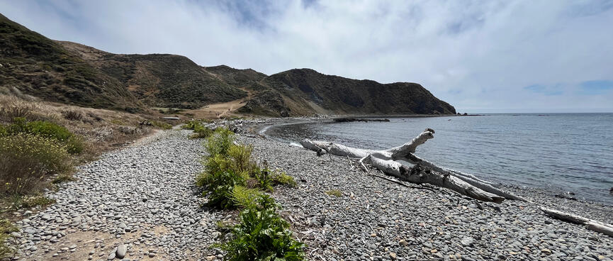
The beach itself is covered in driftwood with the remainder being small pebbles. Keen to make it two-for-two, I strip off and head into the water for my second swim in as many hours. A family make lunch nearby and every so often a walker passes by.
As I go to leave, I see a pocket-sized pickup truck parked just off the path. It belongs to a farming couple who have come to the beach to dive for their dinner. I ask them about the best place to top up my water. The man says that the river at Mākara Beach would have been the best place, but when I say that I'm going in the opposite direction and right the way around he looks surprised. The last time he went right the way around in this kind of weather all the creeks had dried up.
This is dire news indeed. Even if I walked non-stop, it's still a solid 12 hour hike to get to the other end. The remnants of a 2L hydration bladder aren't going to cut it and dehydration in remote and challenging places is a recipe for disaster.
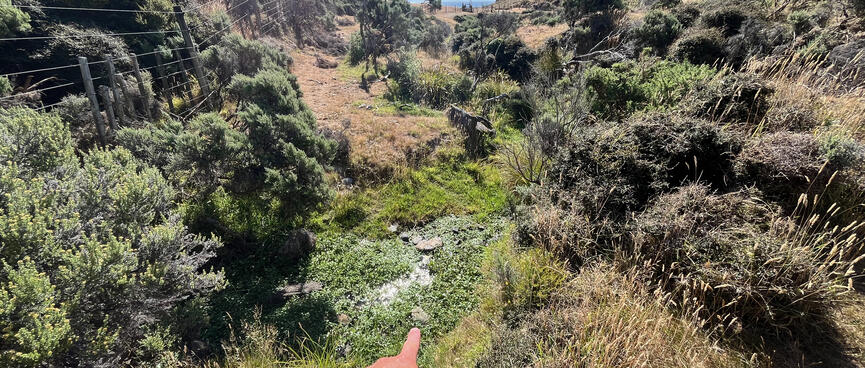
Dejected, I head back to the creek and follow it upstream, hunting for cleaner water. A family walk past and the father tells his thirsty daughter that the water isn't safe to drink here. I hope that the reservoir's LifeStraw 2-stage filter makes the rules different for me.
The water looks best just before it disappears under a fence. There, surrounded by small, healthy-looking green plants, I fill up my Camelbak.
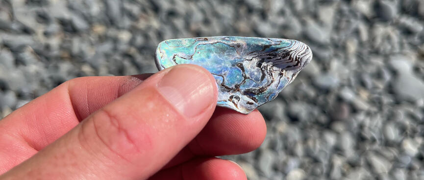
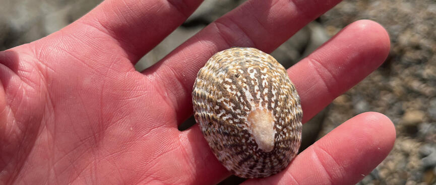
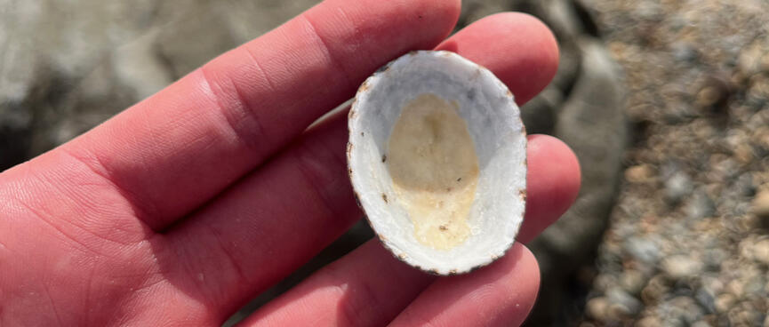
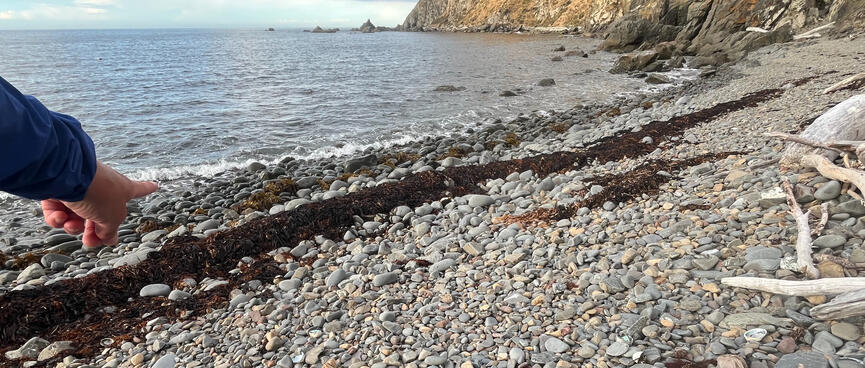
Picking up the path where I left off I see an Object Of Interest in the pebbles.
It's a shard of Pāua shell, adorned with an artistic snapshot of wave energy. It's corners smoothed and bevelled by natural forces, it feels good in my hand. But I resist the urge to pocket it. Take only photos, leave only footprints.
A bit further on, an empty tub of Olivani margarine lies on the beach. Someone didn't get the memo.
It's a scorcher, so when I see a pool of shade I seize the opportunity for a cool breather.
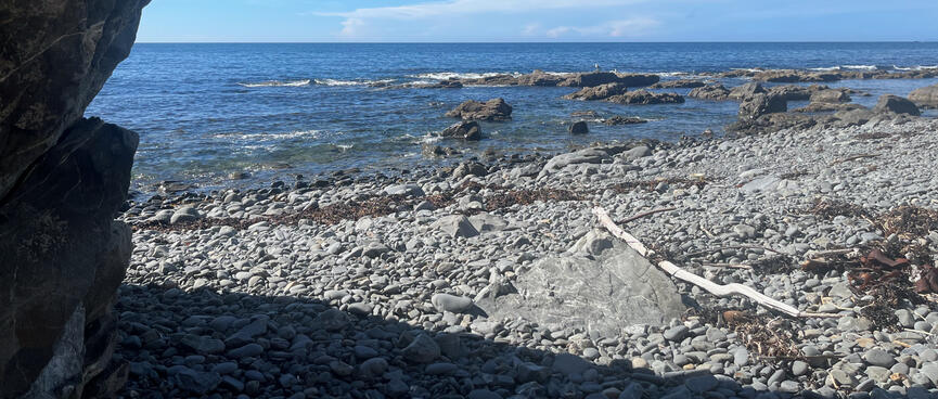
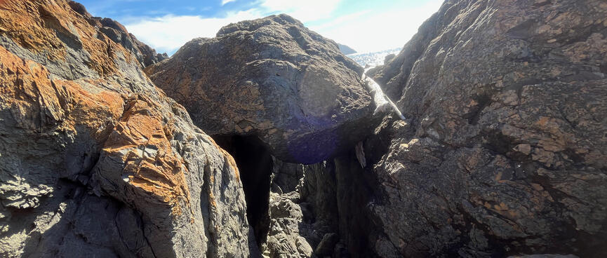
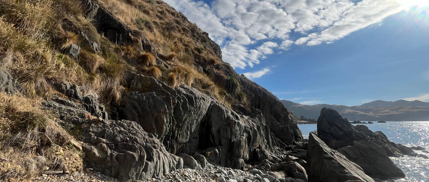
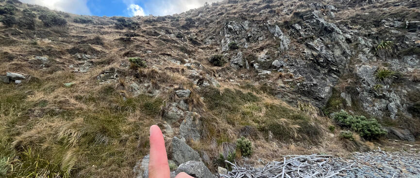
It's a wise move because soon the pebbly path is transformed into a scramble over bucket-sized boulders.
Rocky outcrops intermittently block progress. Where possible, I clamber up the left hand (hill) side in order to avoid a fall into the sea.
Walking becomes easier with a companion stick, which can be obtained by visiting one of the many 'stick shops' (piles of driftwood) scattered across the landscape. However no matter how perfectly formed the stick appears to be, it's wise to practice detachment as some obstacles aren't stick-friendly and it's easier to just pick up a new one on the other side.
More shade, another lie down. This time I'm lying on solid rocks, yet somehow my body picks out a natural mattress, my head preferring the semisoft surface of my hiking pack.
A large part of the reason I felt confident about tackling this remote hike is due to the excellent trip notes posted online by the WTMC.
Of special interest is the advice relating to the part of the trail which I'm currently up to, the rock rib.
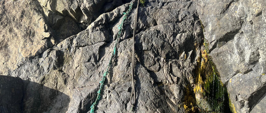
The WTMC (Wellington Tramping and Mountaineering Club) posted a YouTube video of them doing a rope descent down the rock rib, which blocks the coastline (opens new window).
As far as I can tell, one has to contort oneself to grab onto a handhold at the top of the climb, then grab on to the rope, lower oneself down to the first foothold, then rely on pointers from a spotter on the ground in order to find the remaining footholds, before inevitably falling the final metre or so onto pebbles below.
I'm not a fan of heights and this was always going to be a solo mission, so I find myself lacking crucial information about how to proceed down the wall without a spotter.
The WTMC page where the video is embedded, Makara Beach to Red Rocks (opens new window) (16.01.2021), links to Harry’s trip guide Makara Beach to Owhiro Bay (Red Rocks) (opens new window) (30.03.2019), which actually just copies and pastes Harry's response to a forum post misspelled Makara beach to Ophiro Bay (opens new window) (29.10.2014).
Anyway, Harry has this to say about the ropes:
The next kilometre or two into Te Ikaamaru Bay is probably the trickiest part of the trip. There are two obstacles to get past. First is a rock rib which blocks travel along the beach. You need to climb up the hillside above it, sidle around, and then drop steeply back down to the beach beyond it. (There used to be a rope attached to one side of this rock rib to help you over it but I don’t know whether it is still there.) (The rope is still there and usable. TG)
Harry & TG (Tony Gazley), from Makara Beach to Owhiro Bay (Red Rocks) (opens new window) (30.03.2019)
Needless to say that I was deeply nervous about breaking an ankle in the middle of nowhere and having to activate my inReach's SOS function in order to get airlifted out. Clearly I needed a backup plan and preferably one for that too.
Note: The mash of links and duplicate information led me to ignore an earlier video, embedded in the report from 30.03.2019, which actually shows the rope descent from the far side: Makara Beach to Ohiro Bay (Vimeo) (opens new window).
My backup plan was to 'sidle around', but looking at the terrain in front of me I'm glad that I also have a backup plan for my backup plan.
This comes courtesy of a YouTube tutorial by Specialist Pous (Pousinboots) on How to Cross a River with a Rucksack (opens new window).
The Pousinboots method is:
The Pousinboots method appeals because I recently purchased a SwimSecure Dry Bag (opens new window), so I'm familiar with the concept of pulling dry things through a wet medium.
The 28L dry bag was too small for this hike, but I've brought the waist leash in place of a tow rope. I've also opted for bike bungees, as I'm not very good at remembering knots in high-stress situations.
Specialist Pous's demonstration is rock solid but it's his offhand reference to physics principles that really blows my mind:
The rucksack weighs around 23 kilos .. so it's, it's pretty heavy, but again, Archimedes' Law: the volume in litres, if it exceeds the weight in kilos, it will float
Specialist Pous, from How to Cross a River with a Rucksack (opens new window) (21.09.2021)
At school I sucked at physics (and maths, and science), partly because my brain isn't wired that way and partly because I didn't see the point in learning things that had no practical application. Well, I stand corrected - and I will never look at a soldier the same way again!
Applying these principles, I stuff my boots and clothes into my pack, wrap it up in Big Black Sacks (opens new window), tie it off with bike bungees, clip the leash to my waist, put on my goggles, and away we go!
Gingerly tiptoeing my way over the rocks into the sea, I kick off and head around the rock on my reverse-portage.
I stay as close to the coast as practical, worried that wind and currents could hijack my progress further out.
But it's quickly apparent that towing a bulky rubbish bag by this waist leash is different to towing a specialist ocean dry bag, the core difference being that the pack gets in the way of my feet more, making it much harder to kick. This in turn requires my arms to work harder, with the result that I quickly tire and it is something of a struggle to make it to my destination of the second bay after the rock rib.
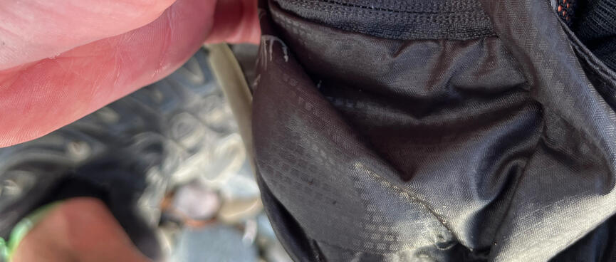
The second difference is apparent after an uncomfortable exit over underwater boulders, during which I nervously watch the bag knock against rocks protruding from the waterline, while simultaneously wishing that I owned and had brought sandals to counter the uncomfortable underfoot experience. Carefully removing the rubbish bags I'm disappointed to find that my pack has patches of wetness, and that the internal roll-top Ultra-Sil packliner has also come undone during the bumpy ride.
Upending the black polythene rubbish bags, a cup's worth of sea water sprays out. While the contents of the packliner seem more or less dry, overall it feels like a failed attempt at greatness. It's possible that the rocks knocked holes in the bags, but more likely that the bike bungees simply couldn't achieve the same level of seal as specialist knots - the inevitable cost of cutting corners.
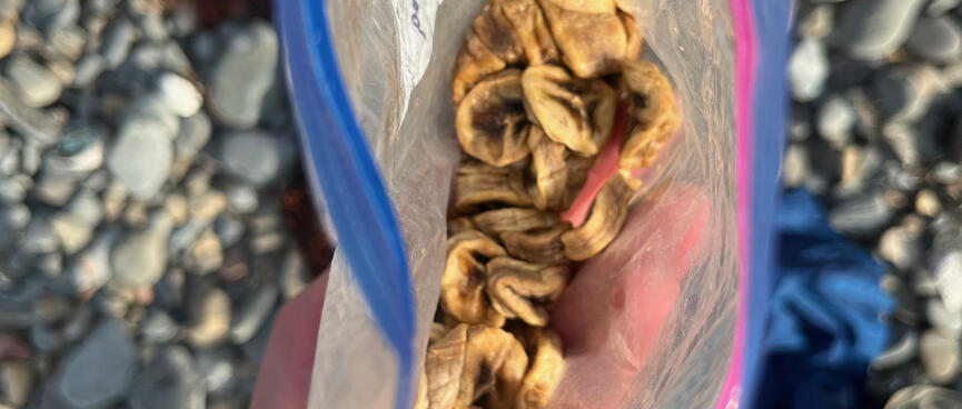
I sit on the beach and break out my dehydrated bananas, which aren't actually sufficiently dried, another fail. Regardless, they'll rapidly replenish my energy levels - I'm not at my campsite yet.
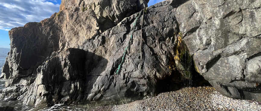
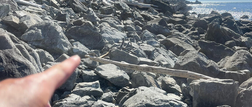
After dressing, I walk back to the rock rib to take photos of the far side for the benefit of other solo travellers.
It definitely looks like the first foothold is the only foothold, and from there one has to dab off the vertical face.
Alternatively, one could perhaps make their way over to the dreamy waterfalls on the right hand side, except for.. AAAAAARGH! THE FLIES!!!!!
The next obstacle is straightforward, but the one after that requires another detour and some serious leg work.
Tired after swimming around the last rock rib, the thought of another swim doesn't appeal. The hill seems easier, but it's steep - time to go vertical.
Scramble, scramble, scramble, scramble. There's a reason why they call it scrambling and not walking. Because one does not normally walk with one's knees. One's fingers do not bleed when one does not need to claw one's way through patches of scree, keeping one's weight low to avoid falling off the face of the planet. Scramble, scramble, scramble. Keep moving, don't look down, don't grab that bit of crumbly rock, don't get complacent, don't stop 'til you get to the top.
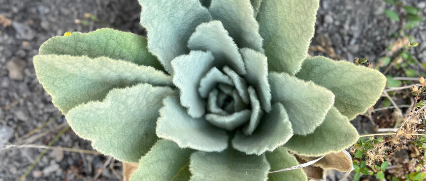
The silver lining is the nice smelling plants which are well attached to the hillside. Though much smaller than me, I learn that they'll happily support my body weight. The other big help is the inch-thick roots which emerge here and there, literally providing handles for me to leverage off. Go plants!!
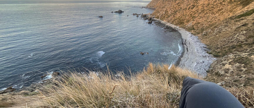

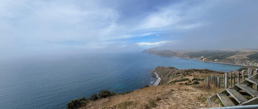
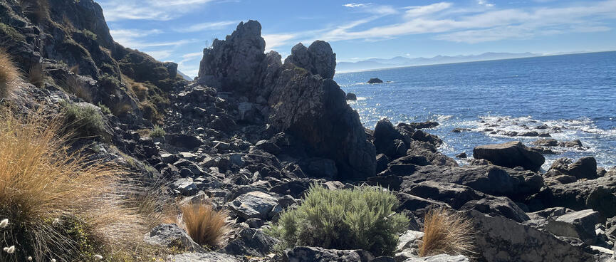
Eventually I reach the tussock on the tops and begin my traverse of the hillside.
The views are awesome but now I have a different problem. The angle of the hill makes it difficult to see what lies below, so I'm not sure where the beach blockage ends and where I should therefore make my descent.
While it was difficult to pick a safe route from the bottom, it could be done metre-by-metre. But from the top the only way to pick a route that way would be to go down feet-first and with the steep angles that doesn't appeal to me. So here I am at the top, feeling like a housecat who leapt into a tree to escape an angry dog, only to find itself trapped in a different way - and now waiting for its owner to bring a ladder to carry it down.
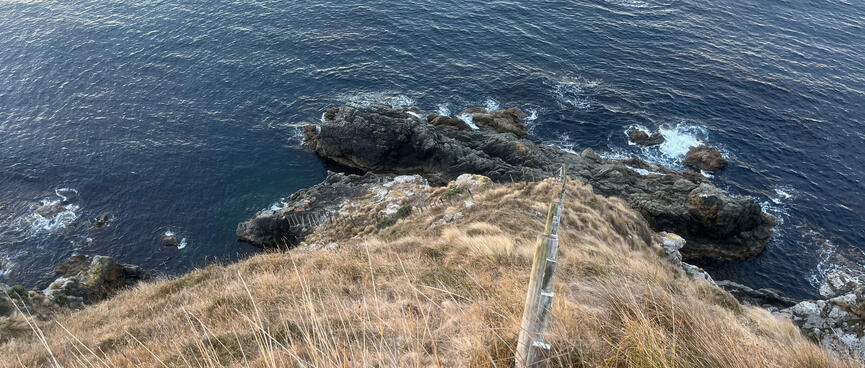
I continue along the tussocky side of the hill until I reach a fence. Following the fence up a very steep hill I reach another fence. I'm fenced in!
Clearly I'm not supposed to be up here, but I'm running out of options. I can see a road above, but I agreed with the farm manager that I'd stick to the coast wherever possible. Maybe I'm taking that too literally but, as Omar Little once said, a man's got to have a code.
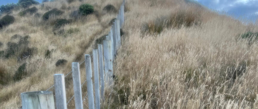
I climb over the fence and continue in the direction of the coastline. But the hill drops away suddenly, so I retrace my steps and walk straight up the fenceline. Hauling myself up the hill one fencepost at a time I drink, sweat and reflect on how my innocent forays often lead to extreme hardship as the sun sets and I'm nowhere near my destination.
Firing up MapOut, I see that I should be able to follow my present course as the gradient will taper off when I reach Te Ikaamaru Bay. Eventually the paddock transitions into an old 4WD track. Following this down I reach a stream. There are some animal droppings around but the water is running so I top up my hydration bladder anyway.
From my highpoint I could see buildings surrounded by trees, but when I reach ground level I can't see the buildings for the trees.
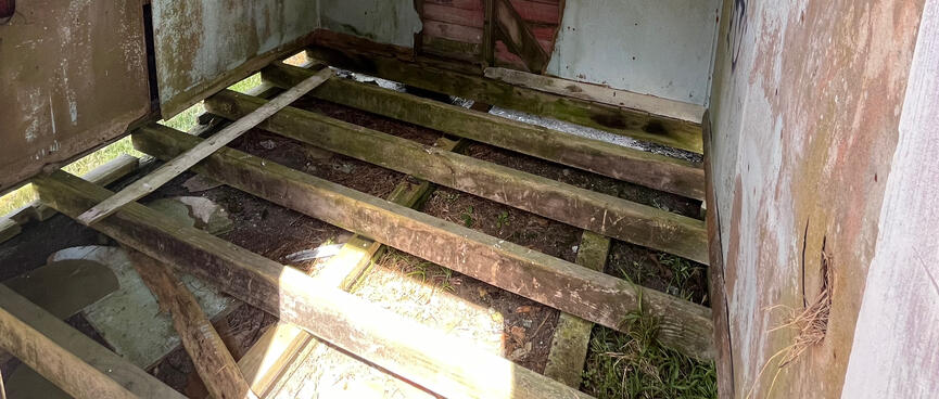
Continuing on, I find a smaller building than expected, labelled with an out-of-place suburban street sign which reads PEARCE ST. Locked metal shutters conceal its doors and windows and there's an uneven dirt yard containing a rickity DIY picnic table. Another stand of trees is visible further down the bay, but it's after 9pm and my Nitecore GITD keylight lacks the power to illuminate them in the evening gloom.
I unpack onto the picnic table but as I unroll my bivvy bag I'm surprised to hear a loud banging emanate from the building - perhaps an invitation to leave?
Relocating to a nearby stand of trees, large cow pats litter the ground but I find a clear spot at the base of a tree and fence it off with driftwood. I'm tired and sweaty and would love a swim but it's dark now so I can't.
Tomorrow.